
Aerial Photography
Foxhaven Photography elevates your visual perspective with exceptional aerial photography services. Specializing in drone imagery, we bring a unique aerial viewpoint to your real estate listings, commercial projects, and scenic properties. As an FAA Part 107 certified operator, I can take your visual presentation to new heights, offering a view that ground-level photography simply can't match.
Elevating Your Vision: Our Approach to Aerial Photography
The right perspective is everything. Our aerial photography and videography services are designed to provide that unique, compelling view that truly sets your property or project apart. By combining the latest drone technology with our expertise in photography, we offer an unparalleled aerial perspective that ground-level photography cannot match. Our approach is tailored to meet the diverse needs of our clients. We specialize in delivering high-resolution aerial images that are perfect for real estate listings, commercial developments, architectural projects, and scenic properties.
Serving Central Virginia and Beyond: Based in Charlottesville, VA, we are equipped to serve a wide range of areas. Whether your project is within the central Virginia region or beyond, we are ready to bring our aerial photography services to you. Get in touch and let me help elevate your visual narrative.

Equipped With The Latest Technology.
We stay at the forefront of aerial imaging technology by using the DJI Mavic 3 Pro. This advanced drone is a leader in the industry, known for capturing some of the most stunning, high-resolution aerial photographs and videography hands down.
With its superior camera capabilities and stability, the DJI Mavic 3 Pro allows us to consistently deliver exceptional quality images. Working with us means choosing cutting-edge technology for unparalleled results in your aerial photography needs.
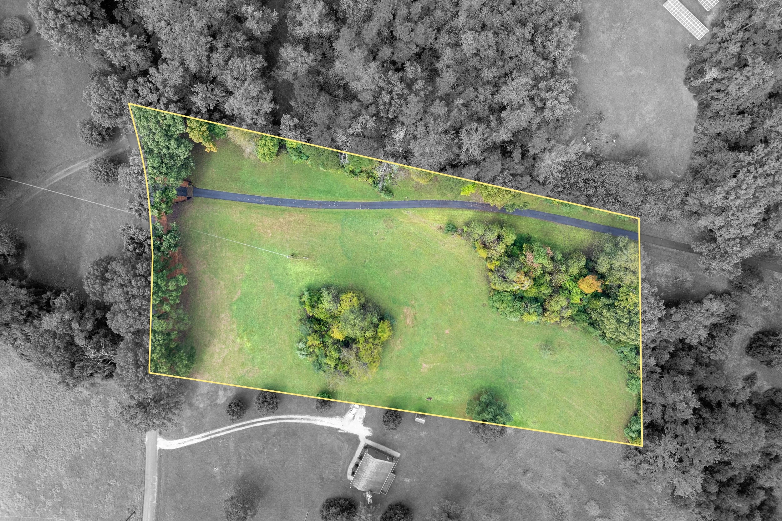
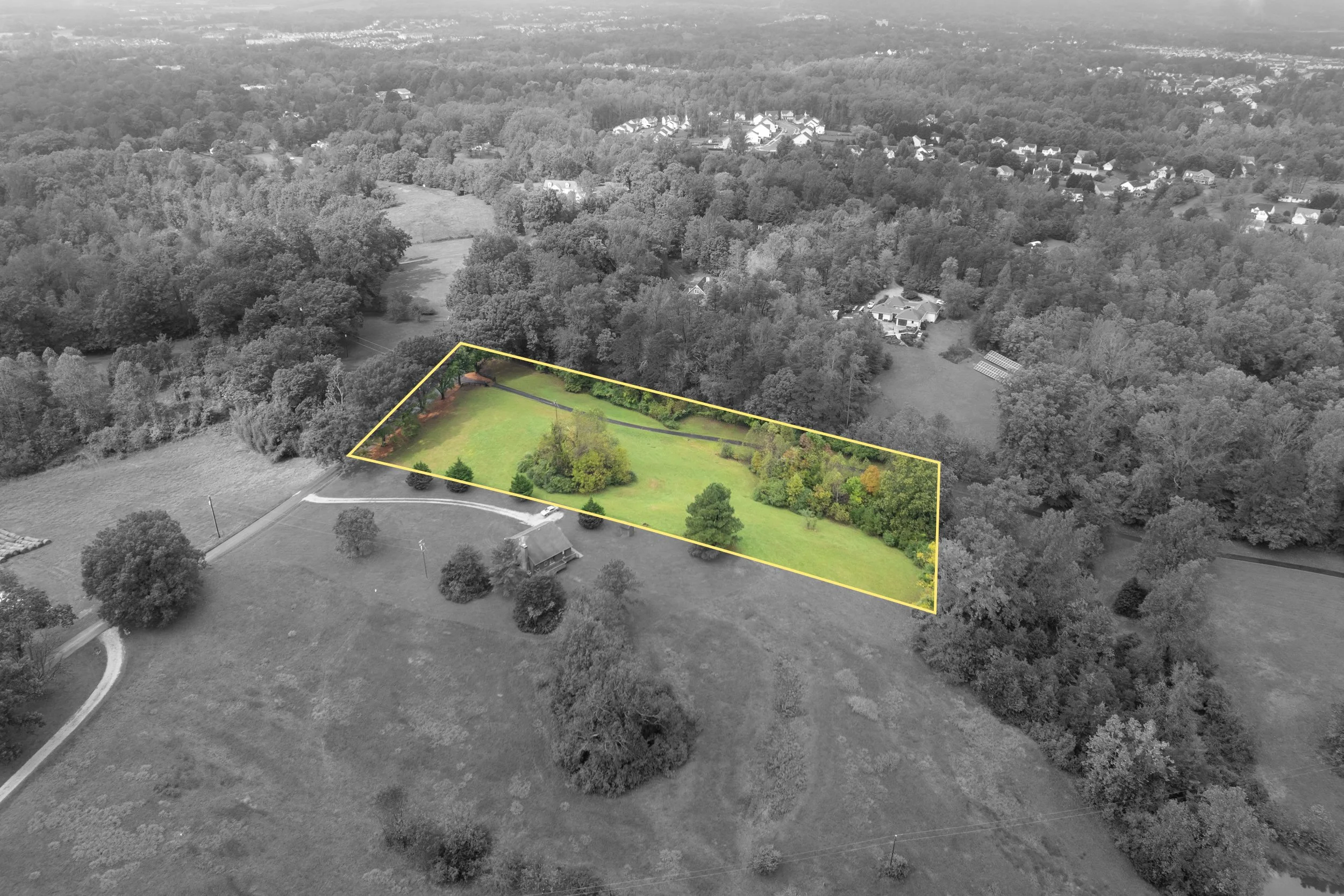
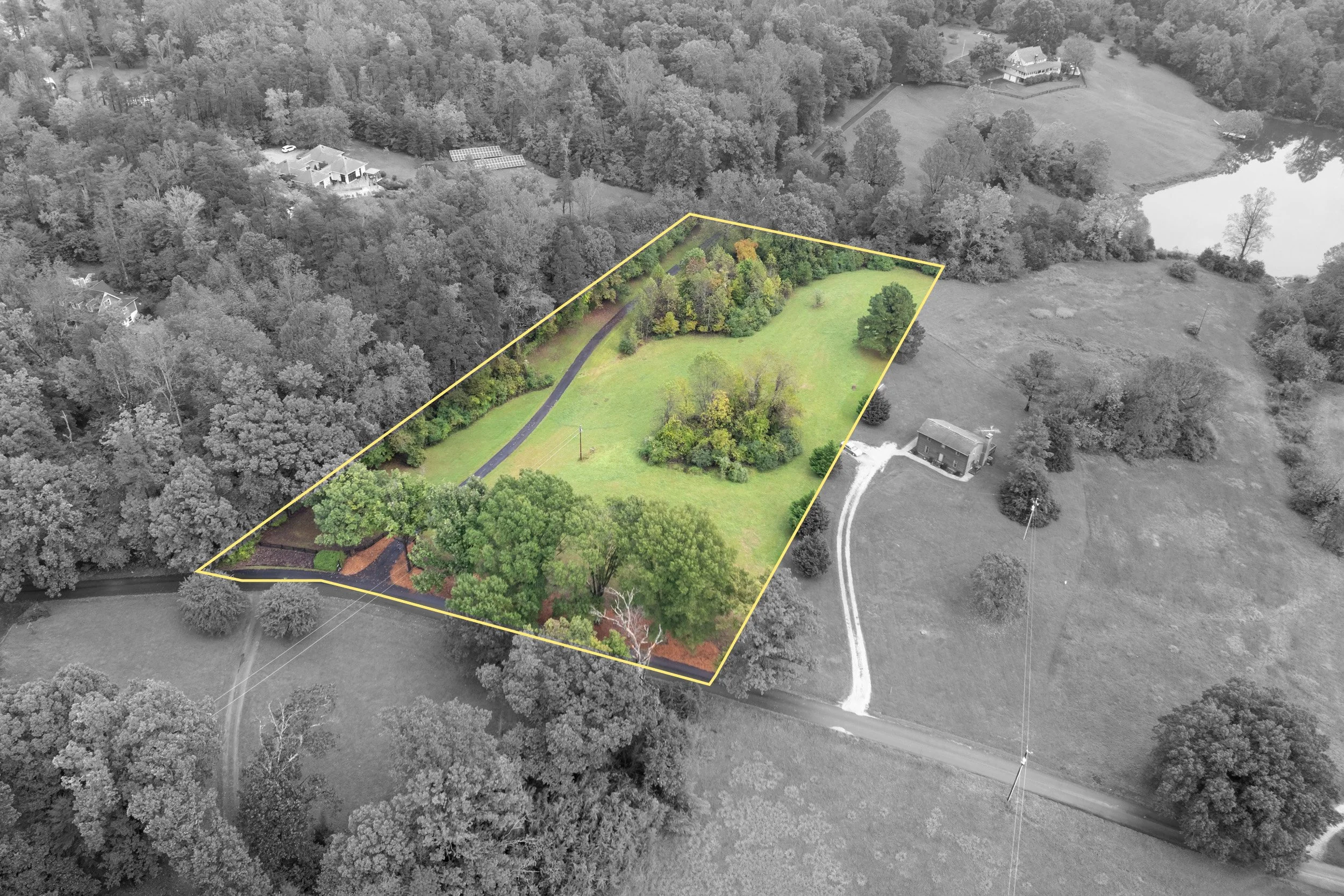
Aerial Property Maps & Boundaries.
Showcase your property’s exact dimensions, acreage, and layout with high-resolution aerial mapping. Whether for real estate listings, land development, or planning purposes, aerial property maps can provide a clear, top-down perspective with accurately marked boundaries.
Our aerial mapping services highlight property lines, key features, and surrounding areas, offering a comprehensive view that standard ground-level photography simply can’t achieve.
Cinematic Aerial Video For Your Listings.
Bring your listings to life with stunning aerial videography that showcases properties from dynamic, cinematic angles. Our professional drone videos provide an immersive experience, capturing sweeping views, unique perspectives, and the full scale of a property in motion.
Ideal for large plots of land, luxury listings, and commercial properties, our high-definition aerial videos highlight key features, surrounding landscapes, and architectural details with smooth, stabilized footage.
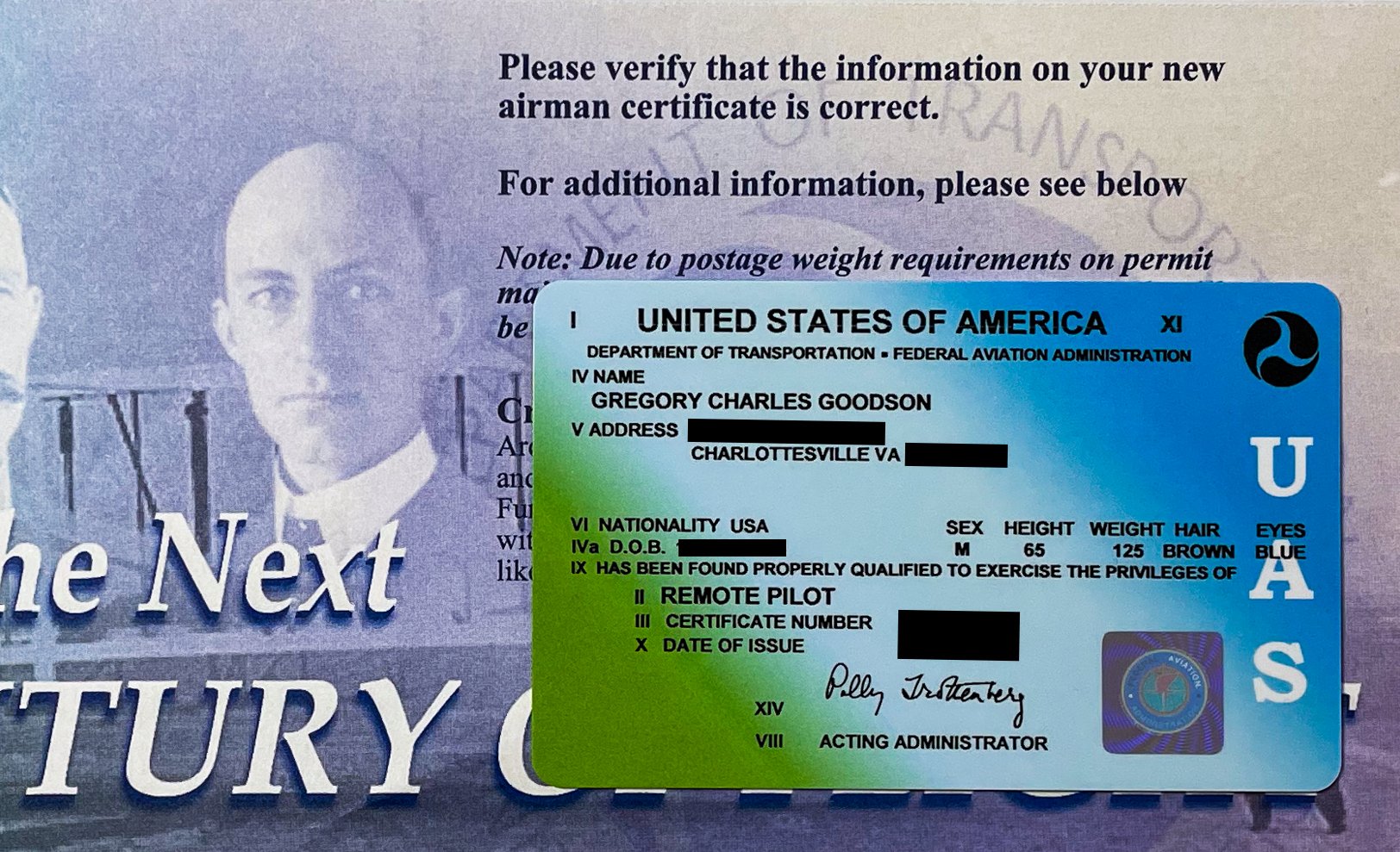
I’m an FAA Part 107 Certified Operator.
When considering aerial photography for your project, it is essential to hire a photographer who is FAA Part 107 certified. This certification represents an understanding of the airspace regulations, safety practices, and operational protocols.
Flying a drone for commercial purposes without FAA certification is a violation of federal regulations; penalties for non-compliance can be substantial. Hiring us ensures compliance, safety, quality, and peace of mind.
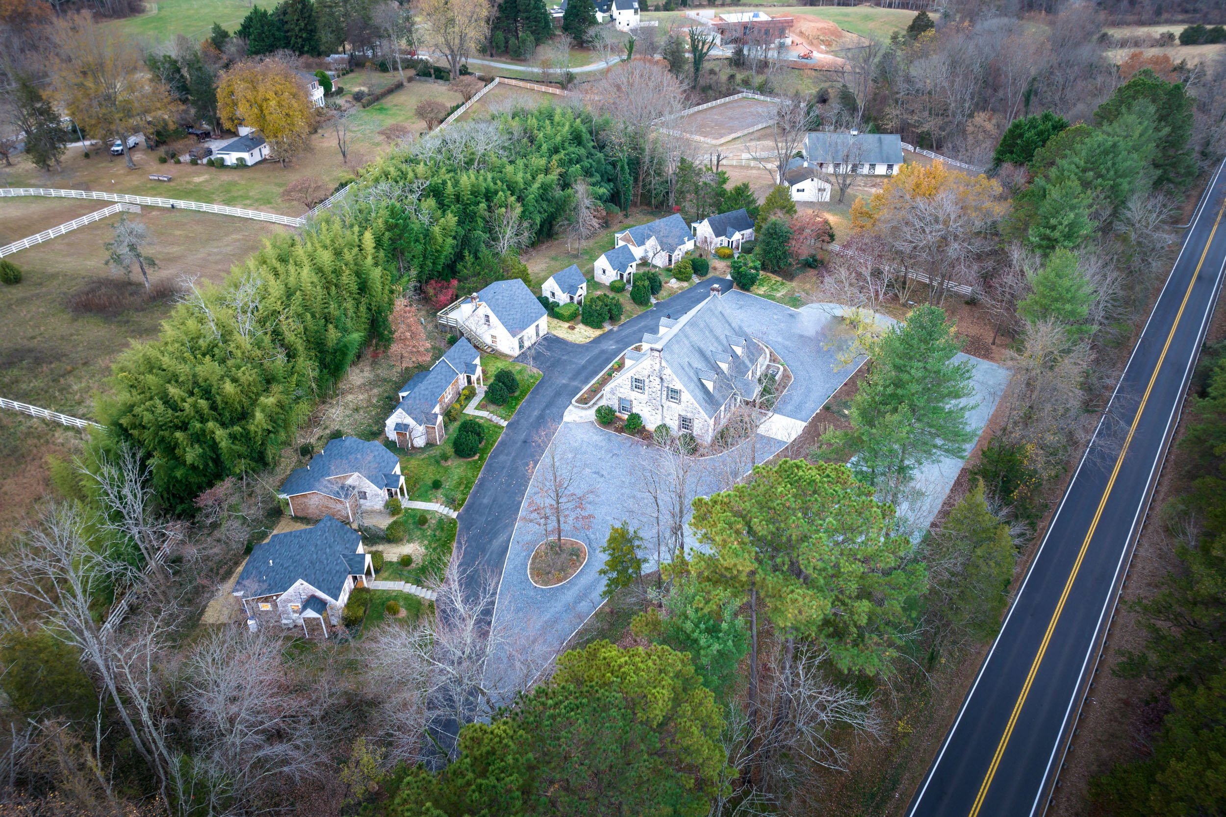
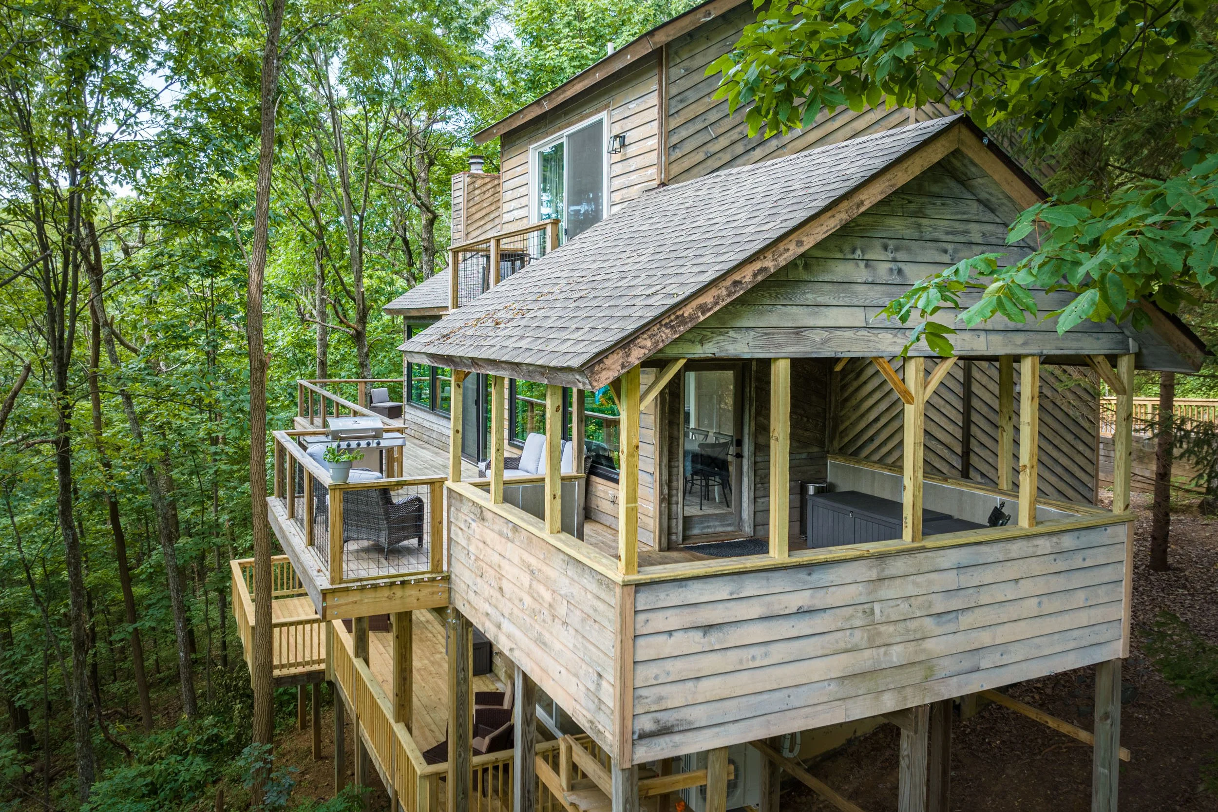
Our Portfolio
Our aerial photography portfolio below showcases the diverse range of projects we've elevated with our unique perspective from the skies. Explore several photographs below to see transformed views of real estate developments, large estates, commercial properties, and scenic landscapes.


Contact Me.
Give us a call at (434) 260-1743 and let me know how I can help.